Rebates


Did you know?
ALL products we sell are factory new and come with the full Manufacturers Warranty!


Boatersland Marine > GPS/Cartography > Cartography > MAX C-Map NT > C-MAP NA-M609 MAX Baja California Bathymetric
  C-MAP NA-M609 MAX Baja California Bathymetric
Click to enlarge

C-MAP NA-M609 MAX Baja California Bathymetric

Item #: CMANA-M609-C


Type: 

Quantity:

Price:

$205.99


Backordered
No restocking fees on return.
 
Click to verify BBB accreditation and to see a BBB report.  

Details:

NA-M609

Baja Directions is a provider of bathymetric and fishinginformation for the Baja California region of Mexico. An extremely popular area forsportfishing, and home to some of the most lucrative fishing tournaments in the world,this new product offers a boatload of improvements to this area including improvedbathymetry, new C-Marina charts and popular fishing grounds and fishing "hot spots".

Coverage:
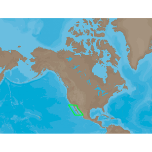
From San Diego, CA down the Baja coast to Cabo San Lucas, MX and all of the Sea of
Cortez with coverage down to Las Tres Marias Islands just northwest of Puerto Vallarta.

Bathymetric Details:
33' intervals to 330'
66' intervals to 660'
330' intervals over 660'
There are 33' contours up to 2,000 ft in Ensenada (Bahia de Todos Santos)Four distinct levels of bathymetric charts providing detail from 5 nm down to 250 feet(Zoom levels will vary depending on plotter screen size)Traditional bathymetric cards provide detail starting at 1 nm.

C-Marina Charts:
We added C-Marina detailed marina chart coverage for 14 important ports along the BajaCalifornia coastline:
1. Ensenada
  • a. Hotel Coral and Marina
  • b. Juanito?s Boats
  • c. Baja Naval
  • d. The Marina at Ensenada


2. Bahia de Tortugas
  • a. Puerto San Bartolome


3. San Carlos
  • a. San Carlos Marina


4. Cabo San Lucas
  • a. Marina Cabo San Lucas


5. Puerto Los Cabos
  • a. The Marina at Puerto Los Cabos


6. La Paz
  • a. Club Cantamar Resort
  • b. Marina Pichilingue
  • c. Costabaja Marina
  • d. Marina Palmira
  • e. Marina de La Paz
  • f. La Paz Harbor


7. Santa Rosalia
  • a. Santa Rosalia Marina


8. Loreto
  • a. Loreto Marina


9. Bahia de Los Angeles
  • a. Villa Vita
  • b. Guillermo?s
  • c. Casa Diaz


10. San Felipe
  • a. Marina Turistica San Felipe


11. Guaymas
  • a. Marina Real San Carlos
  • b. Marina San Carlos
  • c. Hotel Playa de Cortes
  • d. Delfinario Sonora
  • e. Marina Turistica Guaymas


12. Tobolobampo
  • a. Marina Palmira Tobolobampo


13. Mazatlan
  • a. Marina El Cid
  • b. Mazatlan Harbor


14. Puerto Vallarta
  • a. La Cruz Yacht Harbor
  • b. Marina de Nuevo Vallarta
  • c. Paradise Village Marina


Did you Know?

ALL products we sell are factory new and come with the full Manufacturers Warranty!

Related products
C-Map NA-M021 MAX Canada North and East |  C-Map NA-M022 MAX U.S. East Coast and The Bahamas |  C-Map NA-M023 MAX U.S. Gulf Coast and Inland |  C-Map NA-M024 MAX U.S. West Coast and Hawaii |  C-Map NA-M025 MAX Canada West |  C-Map NA-M026 MAX Great Lakes and The Maritimes |  C-Map NA-M027 MAX Central America and Caribbean |  C-Map NA-M028 MAX Alaska |  C-Map SA-M504 MAX South America Gulf Caribbean |  C-MAP SA-M500 MAX Wide Costa Rica - Chile - Falklands |  C-MAP SA-M501 MAX Wide Gulf Of Paria to Cape Horn |  C-MAP AS-M206 MAX Jave & Indonesia |  C-MAP AN-M202 MAX Korea Strait - Okinawa Shima |  C-MAP AN-M203 MAX Yellow Sea Malaya |  C-MAP AS-M201 MAX Gulf Of Thailand - Hainan Dao |  C-MAP AU-M090 The Kimberley Coast - SD Card |  C-MAP AU-M091 MAX Collier Bay - Port Headland |  C-MAP AU-M092 MAX Port Headland - Onslow |  C-MAP AU-M093 MAX Onslow - Coral Bay |  C-MAP AU-M094 MAX Coral Bay - Kalbarri |  C-MAP AU-M095 MAX Kalbarri - Two Rocks |  C-MAP AU-M096 MAX Cape Bouvard - Windy Harbour |  C-MAP AU-M097 MAX Windy Harbour Hope |  C-MAP AU-M098 MAX Hope - Port Eyre |  C-MAP AU-M099 MAX Port Eyre - Port Douglas |  C-MAP IN-M002 MAX Indian Ocean |  C-MAP IN-M202 MAX Maldives - Gulf Of Martaban |  C-MAP NA-M048 Max Lakes - Canada |  C-MAP NA-M321 MAX Cape Henry NC to Apalachicola FL - SD Card |  C-MAP NA-M420 MAX Gulf of Mexico Bathy - SD Card |  C-MAP NA-M609 MAX Baja California Bathymetric |  C-MAP NA-M620 MAX San Diego CA - Cape Blanco OR - SD Card |  C-MAP NA-M621 MAX Cape Blanco OR - Puget Sound - SD Card |  C-MAP Max NA-M050/SD - Lake Michigan Bathymetric SD Format |  C-MAP Max NA-M051/SD - Lake Superior Bathymetric SD Format |  C-MAP Max NA-M052/SD - Lake Huron Bathymetric SD Format |  C-MAP Max NA-M053/SD - Lake Erie & Lake St. Clair Bathymetric SD Format |  C-MAP Max NA-M054/SD - Lake Ontario Bathymetric SD Format

C-MAP NA-M609 MAX Baja California Bathymetric - MAX C-Map NT


9:30 AM - 5:00 PM Eastern, Monday - Friday

facebook twitter