Rebates


Did you know?
ALL products we sell are factory new and come with the full Manufacturers Warranty!


Boatersland Marine > GPS/Cartography > Cartography > MAX C-Map NT > C-MAP NA-M048 Max Lakes - Canada
  C-MAP NA-M048 Max Lakes - Canada
Click to enlarge

C-MAP NA-M048 Max Lakes - Canada

Item #: CMANA-M048-C


Type: 

Quantity:

Price:

$111.99


Backordered
No restocking fees on return.
 
Click to verify BBB accreditation and to see a BBB report.  

Details:

Designed for freshwater fishing and hunting, MAX Lakes delivers the highest level of detail and value-added data not found on any other electronic charts on the market. Also, the MAX Lakes database is constantly growing and is updated yearly!

Features:

  • Shaded Depth Areas
  • Points of Interest (POIs) such as campgrounds, shops, gas stations & more
  • State Fishing Regulations
  • State Hunting Regulations
  • Fish Identification Photos
  • Water Fowl Identification Photos
  • Interstate Highways, Secondary and Lake Roads
    =
  • Boat Ramps
  • National Parks and Recreation Areas

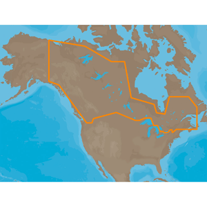
NA-M048 => MAXLakes Canada
Includes coverage for 100 of the most widely recognized lakes in Canada. =Most of the coverage is contained within Ontario with a handful of lakes in =each of the other provinces. Coverage includes Lake of the Woods, Lake Winnipeg, Lake Manitoba, Okanagan Lake, Lake Simcoe, Lake Nipissing and others. Also includes coverage of the Winnipeg River system, Trent-Severn Waterway, MacKenzie River, Rideau Waterway, Ottawa River and St. Lawrence River.

Did you Know?

ALL products we sell are factory new and come with the full Manufacturers Warranty!

Related products
C-Map NA-M021 MAX Canada North and East |  C-Map NA-M022 MAX U.S. East Coast and The Bahamas |  C-Map NA-M023 MAX U.S. Gulf Coast and Inland |  C-Map NA-M024 MAX U.S. West Coast and Hawaii |  C-Map NA-M025 MAX Canada West |  C-Map NA-M026 MAX Great Lakes and The Maritimes |  C-Map NA-M027 MAX Central America and Caribbean |  C-Map NA-M028 MAX Alaska |  C-Map SA-M504 MAX South America Gulf Caribbean |  C-MAP SA-M500 MAX Wide Costa Rica - Chile - Falklands |  C-MAP SA-M501 MAX Wide Gulf Of Paria to Cape Horn |  C-MAP AS-M206 MAX Jave & Indonesia |  C-MAP AN-M202 MAX Korea Strait - Okinawa Shima |  C-MAP AN-M203 MAX Yellow Sea Malaya |  C-MAP AS-M201 MAX Gulf Of Thailand - Hainan Dao |  C-MAP AU-M090 The Kimberley Coast - SD Card |  C-MAP AU-M091 MAX Collier Bay - Port Headland |  C-MAP AU-M092 MAX Port Headland - Onslow |  C-MAP AU-M093 MAX Onslow - Coral Bay |  C-MAP AU-M094 MAX Coral Bay - Kalbarri |  C-MAP AU-M095 MAX Kalbarri - Two Rocks |  C-MAP AU-M096 MAX Cape Bouvard - Windy Harbour |  C-MAP AU-M097 MAX Windy Harbour Hope |  C-MAP AU-M098 MAX Hope - Port Eyre |  C-MAP AU-M099 MAX Port Eyre - Port Douglas |  C-MAP IN-M002 MAX Indian Ocean |  C-MAP IN-M202 MAX Maldives - Gulf Of Martaban |  C-MAP NA-M048 Max Lakes - Canada |  C-MAP NA-M321 MAX Cape Henry NC to Apalachicola FL - SD Card |  C-MAP NA-M420 MAX Gulf of Mexico Bathy - SD Card |  C-MAP NA-M609 MAX Baja California Bathymetric |  C-MAP NA-M620 MAX San Diego CA - Cape Blanco OR - SD Card |  C-MAP NA-M621 MAX Cape Blanco OR - Puget Sound - SD Card |  C-MAP Max NA-M050/SD - Lake Michigan Bathymetric SD Format |  C-MAP Max NA-M051/SD - Lake Superior Bathymetric SD Format |  C-MAP Max NA-M052/SD - Lake Huron Bathymetric SD Format |  C-MAP Max NA-M053/SD - Lake Erie & Lake St. Clair Bathymetric SD Format |  C-MAP Max NA-M054/SD - Lake Ontario Bathymetric SD Format

C-MAP NA-M048 Max Lakes - Canada - MAX C-Map NT


9:30 AM - 5:00 PM Eastern, Monday - Friday

facebook twitter